Key Highlights
- A nor’easter is battering the East Coast with heavy wind and rain, with forecasters warning the worst conditions are still ahead.
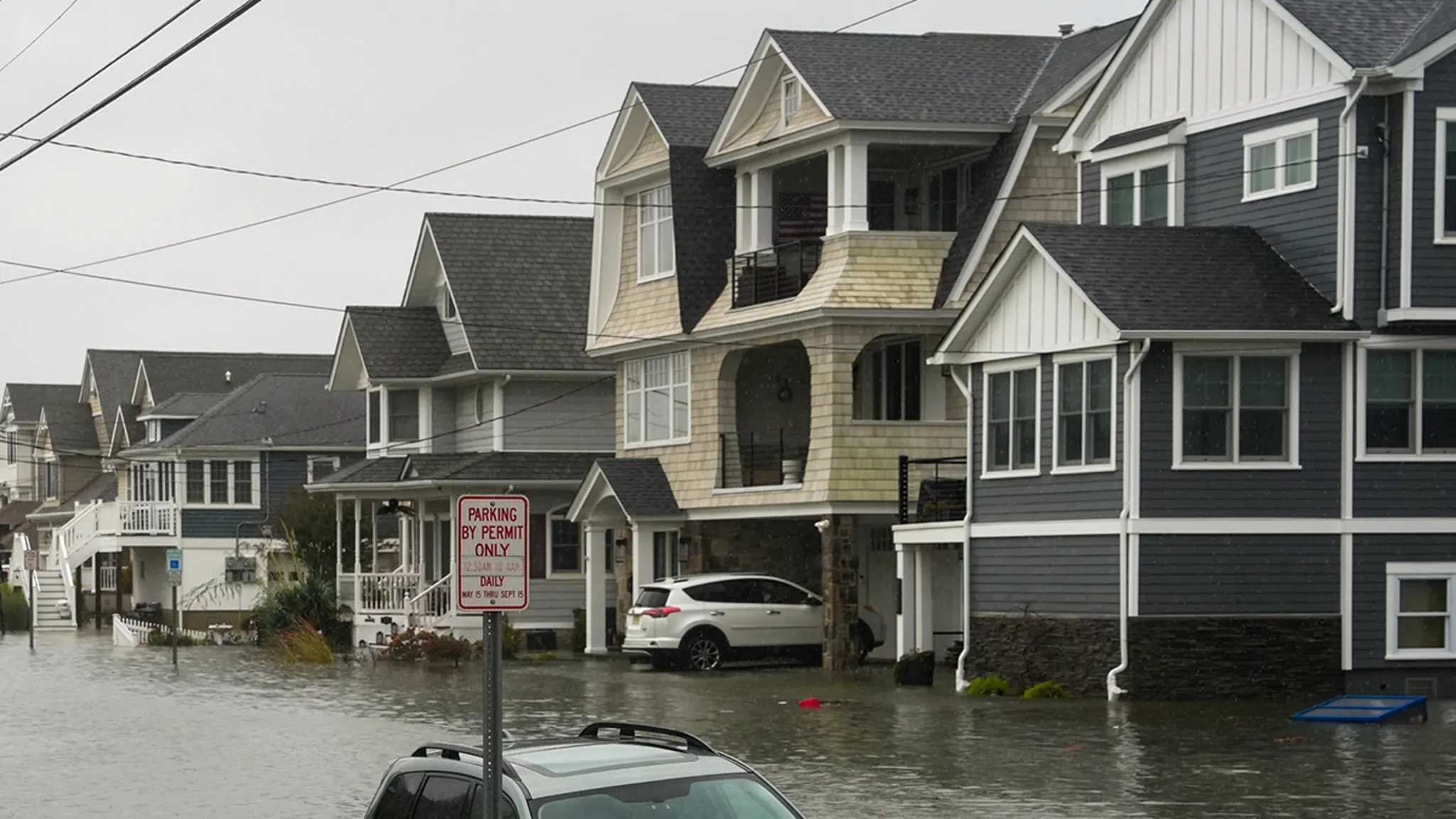
- Photos and video footage document devastating coastal flooding, particularly along the Jersey Shore.
- The storm system continues to intensify, prompting emergency preparations across multiple states.
Nor’easter Slams East Coast as Flooding Escalates
A powerful nor’easter system has been pummeling the East Coast with heavy wind and rain, unleashing dangerous conditions that meteorologists say will worsen in the coming hours. The storm has already generated devastating coastal flooding, with the Jersey Shore emerging as one of the hardest-hit regions. Visual documentation circulating overnight captures the rapid escalation of floodwaters inundating shoreline communities.
Jersey Shore Bears Brunt of Initial Impact
Among the hardest-hit areas is the Jersey Shore, where video taken last night reveals the destructive force of storm surge combining with astronomical high tides. The footage shows seawater breaching dunes, overwhelming bulkheads, and flooding roadways in communities accustomed to coastal storms but unprepared for the speed and volume of this event. Emergency management officials along the New Jersey coastline have activated response protocols as reports of stranded vehicles and structural damage increase.
Forecasters Warn Peak Intensity Still Ahead
Even though significant flooding has already occurred, meteorological projections indicate the worst is yet to come. The nor’easter continues to deepen as it tracks northeastward, drawing abundant Atlantic moisture into a tightening pressure gradient. This configuration will sustain prolonged periods of onshore flow, stacking successive high tide cycles with increasing wave action and rainfall totals. The extended duration of the event—spanning multiple tidal cycles—amplifies the cumulative flood threat beyond what a single surge event would produce.
Why This Matters
Nor’easters represent one of the most disruptive weather hazards for the densely populated Northeast corridor. Unlike tropical systems that typically accelerate through the region, these extratropical cyclones often stall or move slowly, subjecting coastal and inland areas to prolonged battering. The combination of storm surge, freshwater flooding from heavy rainfall, and high winds creates compound hazards that strain infrastructure, overwhelm drainage systems, and complicate evacuation and rescue operations. With sea levels rising along the Mid-Atlantic coast, the baseline for coastal flooding has shifted upward, meaning storms of this magnitude now produce impacts that would have required stronger systems in previous decades. Emergency managers emphasize that the multi-day duration of this event requires sustained public vigilance rather than a single preparation window.
Frequently Asked Questions
What areas face the greatest threat from this nor’easter?
The Jersey Shore has been identified as among the hardest-hit regions so far, but the entire East Coast from the Mid-Atlantic through New England faces significant coastal flooding, heavy rainfall, and damaging winds as the system progresses.
How long will the storm’s impacts last?
Forecasters indicate the worst conditions are still ahead, with the nor’easter expected to affect the region through multiple tidal cycles. The prolonged duration—spanning several days—means flooding threats will persist across successive high tides.
What makes this nor’easter particularly dangerous?
The combination of heavy rain, sustained onshore winds, storm surge, and the storm’s slow movement creates compound flooding hazards. The system’s duration across multiple high tide cycles amplifies coastal flood risks beyond a typical single-cycle event.